New Study Advances Blue Carbon Monitoring with Drone‑Based LiDAR
C‑BLUES researchers have contributed to a newly published scientific paper demonstrating how cutting‑edge remote sensing technology can transform the way we map and measure blue carbon ecosystems.
The study, “High‑Resolution Three‑Dimensional Mapping of Eelgrass (Zostera marina) Habitat and Blue Carbon Using Drone‑Borne LiDAR” by Charles P. Lavin, Toms Buls, Robert Nøddebo Poulsen, Hege Gundersen, Kristina Øie Kvile, Øyvind Tangen Ødegaard, Kasper Hancke, was published in Remote Sensing and showcases an innovative approach to monitoring seagrass ecosystems and their carbon storage potential.
A New Perspective on Seagrass Ecosystems
Seagrass meadows are vital blue carbon ecosystems, storing significant amounts of carbon while also supporting biodiversity and protecting coastlines. However, accurately measuring their structure and carbon stocks has long been a challenge.
This study introduces a novel solution: the use of drone‑borne LiDAR (Light Detection and Ranging) to capture high‑resolution, three‑dimensional data of submerged vegetation.
By using drones equipped with topobathymetric LiDAR sensors, the research team was able to map both the seafloor and eelgrass canopy structure in exceptional detail, opening new possibilities for assessing habitat complexity and carbon storage capacity.

YellowScan Navigator in Tromsø, Norway. Photo by Trygve Heide.
Key Findings
The study demonstrates several important advances for blue carbon science:
3D habitat mapping: High‑resolution digital models were used to reconstruct eelgrass beds and quantify their structure in three dimensions
Carbon stock estimation: The approach enabled direct estimation of above‑ground carbon stored in eelgrass tissues
Improved monitoring tools: Drone‑based LiDAR offers a cost‑effective, reproducible, and highly detailed method compared to traditional field surveys or lower‑resolution satellite data
Importantly, this is among the first studies to apply drone‑borne LiDAR to quantify habitat volume and carbon storage in marine vegetation, marking a significant methodological step forward.
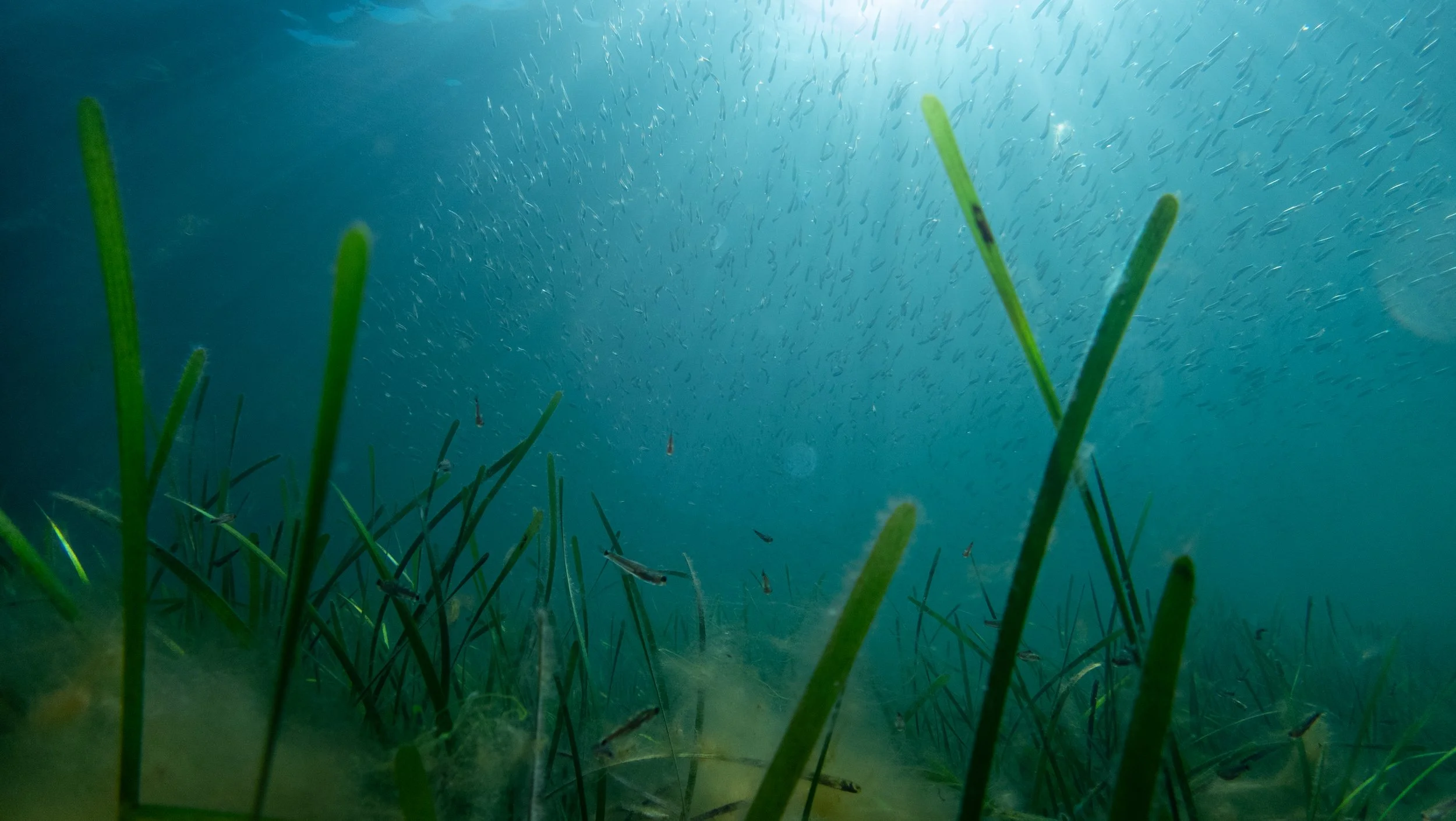
Eelgrass meadow in Drøbak, Norway. Photo by Trygve Heide.
Why It Matters
Accurate measurement and monitoring are essential for integrating blue carbon ecosystems into climate policy and management frameworks.
Traditional methods—such as diver surveys—are often labor‑intensive and limited in spatial coverage, while satellite approaches can lack the resolution needed to capture fine‑scale ecological variability. This study bridges that gap by providing high‑resolution, scalable data that can support:
Improved greenhouse gas accounting
Better ecosystem management and restoration planning
Stronger scientific foundations for policy development
Supporting the C‑BLUES Mission
This research directly aligns with the goals of C‑BLUES, which aims to improve our understanding of blue carbon ecosystems and strengthen the links between science, monitoring, and policy.
By advancing innovative tools such as drone‑based LiDAR, C‑BLUES partners are helping to build the robust, high‑quality datasets needed to unlock the full climate potential of coastal ecosystems.